


Quick Facts
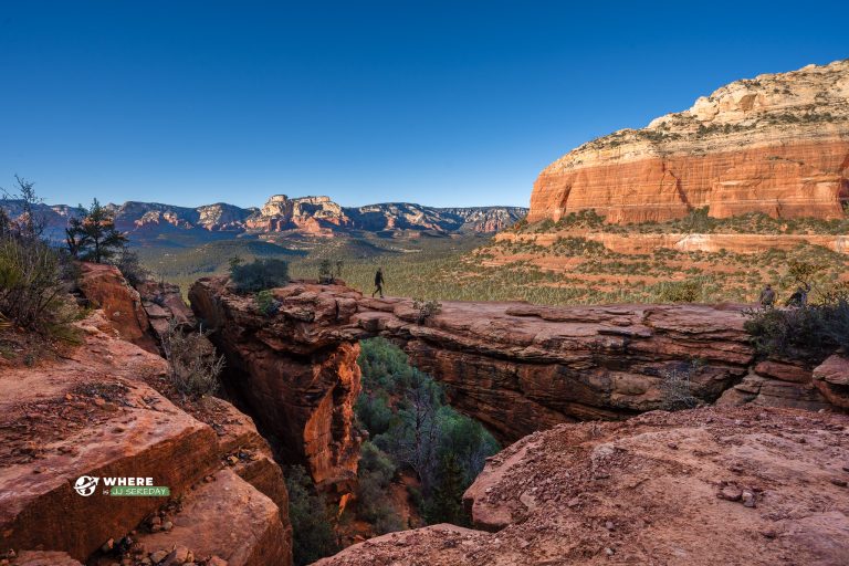
Location: Devil's Bridge, Sedona area, Arizona
Region: Red Rock Country (Northern Arizona)
Trail Length: About 6 to 7 km round trip (route-dependent)
Time: 2 to 4 hours
Difficulty: Moderate (short steep sections near the end)
Admission: Typically free (trailhead parking rules may apply)
Facilities: Trailhead parking, limited services nearby
Best Season: Fall through spring for cooler hiking
Dog Friendly: Yes (on leash, common for Sedona-area trails)
Also Known As: Devil’s Bridge Trail
Info
Parking / Access
Devil's Bridge Trailhead (Sedona)
Parking can be limited and routes may involve dirt roads or different access points depending on conditions. Follow posted signs and local guidance.
Hours
This is generally a daylight hiking area. Start early in warm months and avoid mid-day heat.
Frequently Asked Questions
Where is Devil’s Bridge located?
Devil’s Bridge is in the Sedona area of northern Arizona, within the Red Rock Country landscape.
How do I get to Devil’s Bridge?
Use the Google Maps link above to navigate to a trailhead, then follow posted signage. Access routes can change, so confirm the best option before you go.
Is there parking for Devil’s Bridge?
Yes, but parking is limited and fills quickly on busy days. Arriving early is the best way to avoid long waits.
How long is the Devil’s Bridge hike?
Distance depends on your starting point, but many common routes are around 6 to 7 km round trip.
How long does it take to hike to Devil’s Bridge?
Most hikers take 2 to 4 hours round trip, depending on route choice, crowds, and photo stops.
Is Devil’s Bridge a difficult hike?
It is typically moderate. The final approach can include steep and rocky sections, and the bridge area can feel exposed.
Are dogs allowed at Devil’s Bridge?
Dogs are commonly allowed on leash in Sedona-area trail systems unless posted otherwise. Bring water for your dog and pack out waste.
What should I bring for Devil’s Bridge?
Bring plenty of water, sturdy footwear, sun protection, and layers for changing conditions. If you plan to step onto the bridge, move slowly and be mindful of other visitors.
When is the best time to visit Devil’s Bridge?
Early morning is often best for cooler temperatures and fewer crowds, especially during peak seasons.


