


Quick Facts
Location: Tin Hat Hut, near Powell River, BC
Region: Upper Sunshine Coast
Elevation: ~1,170 m (3,840 ft)
Trail Distance: ~9 km one way (shortest route)
Time: 3–5 hours each way
Difficulty: Challenging
Admission: Donation-based
Facilities: Sleeping bunks, wood stove, outhouse
Best Season: June–September
Dog Friendly: Yes (on leash)
Info
Trailhead Access
Shortest route to Tin Hat Hut
Getting There
From Powell River: Access via logging roads to Lewis Lake trailhead
Trail System: Part of Sunshine Coast Trail (180 km)
Note: 4WD recommended for trailhead access
Frequently Asked Questions
Where is Tin Hat Hut located?
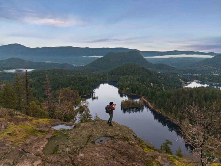
Tin Hat Hut is a remote backcountry cabin perched atop Tin Hat Mountain at approximately 1,170 m elevation, near Powell River on BC's upper Sunshine Coast. The hut is part of the Sunshine Coast Trail system and offers stunning 360-degree panoramic views.
How do I get to Tin Hat Hut?
Access is via the Sunshine Coast Trail from multiple trailheads. The shortest route (approximately 9 km one way) starts from the Lewis Lake trailhead, reached via logging roads from Powell River. Longer routes are available via the full Sunshine Coast Trail. A 4WD vehicle is recommended for trailhead access.
What are the GPS coordinates for Tin Hat Hut?
Tin Hat Hut is at approximately 49.8833°N, 124.3833°W on the summit of Tin Hat Mountain.
Is there a fee to stay at Tin Hat Hut?
The Sunshine Coast Trail huts operate on a donation basis. Contributions help maintain the trail and huts—please give generously to support this incredible resource.
What facilities are available at Tin Hat Hut?
The hut offers sleeping bunks/platforms (bring your own sleeping bag and pad), a wood stove for heating, and an outhouse. There is no running water or electricity. Bring all your own food, water, and cooking supplies.
How difficult is the hike to Tin Hat Hut?
The hike is challenging with significant elevation gain (approximately 600–900 m depending on route). The trail can be muddy and rough in sections. Recommended for experienced hikers with proper gear and navigation skills.
What should I bring to Tin Hat Hut?
Bring a sleeping bag and pad, food and cooking supplies, water or water treatment, warm layers (summit temperatures can be cold), rain gear, headlamp, map/GPS, and emergency supplies. Cell service is not available.
When is the best time to visit Tin Hat Hut?
Summer (June–September) offers the best conditions with clearest views and most reliable weather. Fall can be beautiful but colder. Winter and spring bring snow and challenging conditions—only for experienced backcountry travelers with appropriate gear.
What can I see from Tin Hat Hut?
The summit offers 360-degree panoramic views including Desolation Sound, the Coast Mountains, the Strait of Georgia, and on clear days, views extending far down the coast. Sunrise and sunset from the hut are spectacular.
Is there cell phone service at Tin Hat Hut?
No, cell phone service is generally not available at Tin Hat Hut or along the trail. Plan accordingly, inform others of your itinerary, and carry appropriate safety equipment.
Are dogs allowed at Tin Hat Hut?
Yes, dogs are permitted but should be kept under control. Pack out all waste and be respectful of other hikers staying at the hut.


